
What are Place Types?
Place Types are used to help people visualize the various forms that development can take and to help residents describe the future they envision for their community.
Every place leaves an impression on the people who live there, work there, or visit. Think about popular vacation destinations. Those places typically have a “sense of place” that makes them memorable. They have a strong identity and character that is deeply felt by residents and visitors. Placemaking is a way to shape the future of our communities by focusing on the look and feel of places—their form and character—instead of focusing only on land use.
What makes a place unique, memorable, and loved by the community? Often it’s a mix of natural, cultural, and man-made elements in the landscape. Some key elements that contribute to Chattanooga/Hamilton County’s sense of place include important vistas, the river and its setting within the forested ridges, our diversity of trees, and our historic buildings. Of course, this sense of place can occur at multiple levels - across an entire city, within individual neighborhoods, or in a specific block.
To promote good placemaking, the RPA uses Place Types to influence the form and character of development, and a Centers and Corridors Approach to guide different types of development to the best locations.
 |
 |
 |
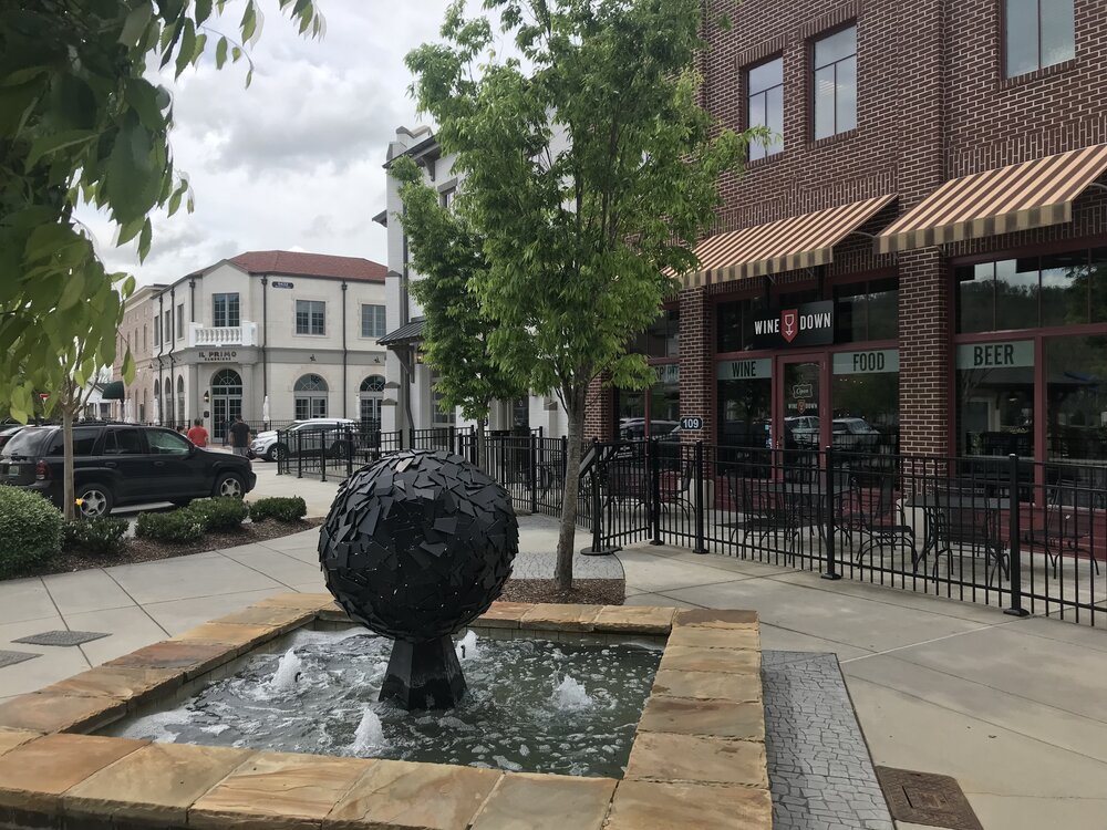
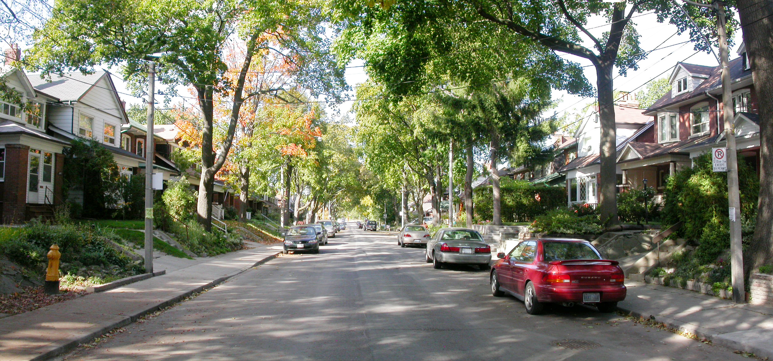
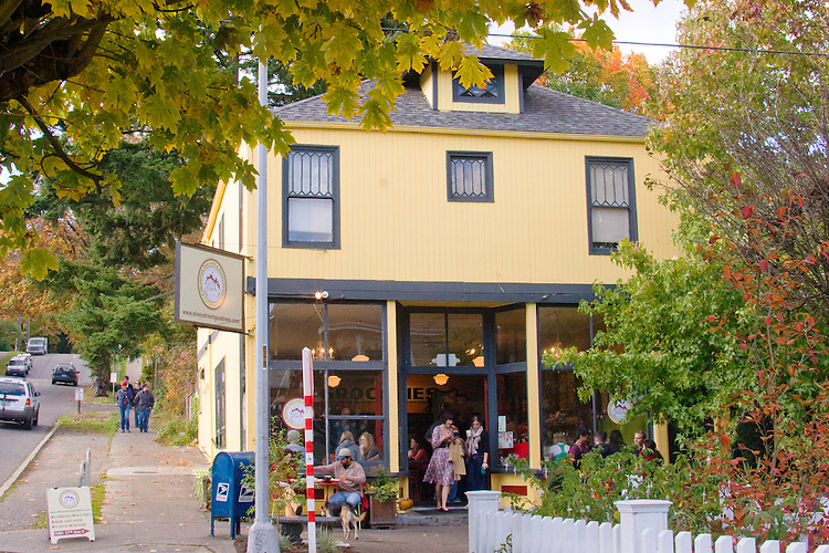
Place Types illustrate a desired character to guide development across a range of community types, from the most urban, to suburban, to the most rural places. This distinction is prominently noted in the names of most of the Place Types, e.g. Suburban Residential, Urban Residential, and Countryside Residential.
Each of the following Place Types includes:
- A two or three letter abbreviation, and the color, used to identify each on the Place Types map.
- A general description of the typical, or ideal, situation.
- A list of characteristics that are generally needed to support the intended development form of the Place Type.
- Examples of the predominant uses. *
- Examples of the limited uses. *
- Illustrative photos, presented as examples only.
* The predominant and limited uses described in these Place Types are not intended to be an exhaustive list, but merely serve as examples of some uses that may be common in a given Place Type.
Note: Our current zoning may not align with some Place Type descriptions. The RPA is embarking on a Zoning Code Update that will better align with these Place Types, promote a mix of uses, and support the Centers and Corridors Approach.
The following list is the basic, general palette of Place Types used as a starting point for each Area Plan. Some customizations may occur for different Area Plans due to a unique situation in that Area. Please refer to each Area Plan for the adopted Place Types, and Place Types map, specific to that Area.
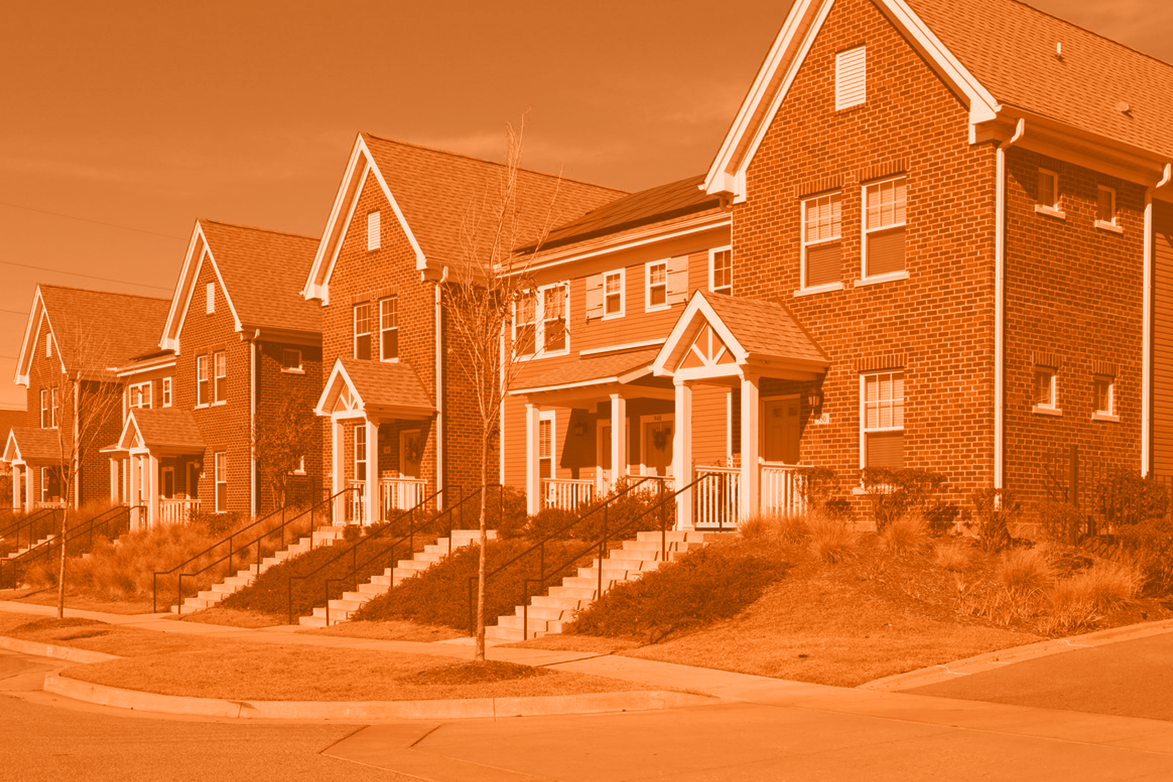
Residential
From single-unit residences to townhomes and apartments, residential Place Types illustrate the desired housing types for an area, whether rural, suburban or urban.
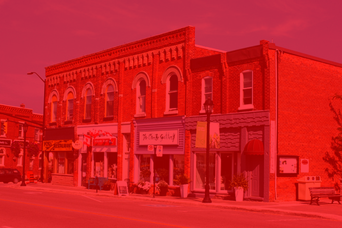
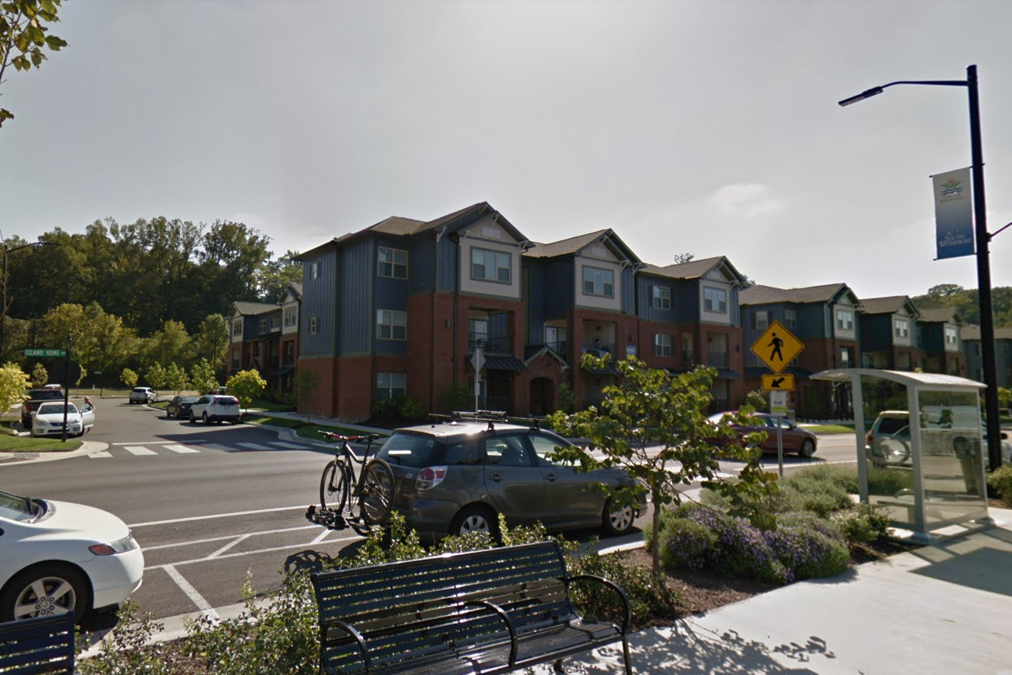
Centers & Corridors
These Place Types include both commercial and residential uses that are either clustered to create a center of activity (Centers), or a linear arrangement of higher intensity uses along a major street (Corridors). Both are walkable and most have the densities and concentration of uses needed to support transit.
- Crossroads (XR)
- Neighborhood Node (NN)
- Neighborhood Center (NC)
- Village Center (VC)
- Town Center (TC)
- Downtown Core (DC)
- Rural Corridor (RC)
- Suburban Corridor (SC)
- Mixed-use Corridor (MC)
- Transit Corridor (TRC)

Specialty Districts
These Place types typically have unique requirements for access, buffering from adjacent uses, or the protection of sensitive natural resources.
- Preserve (PR)
- Agricultural (AG)
- Resort & Recreation (RR)
- Industrial (IN)
- Maker District (MD)
- Industrial Hybrid (IH)
- Campus (CA)
- Regional Facility (RF)

Overlays
Overlays identify areas where additional consideration is needed to address unique assets such as floodplains, steep slopes, or historic properties.
Download a printable PDF version of all the Place Types combined.
How are Place Types Used in Zoning?
Predominant Uses, Limited Uses, and Higher Densities
 Place Types intentionally promote a mix of uses as a means of providing residents with more housing choices and more access to daily needs and jobs. Each Place Type listed above includes examples of potential uses, along with other elements that generally define its character. The uses are divided into:
- Predominant Uses – The most prevalent, most frequently
- Limited Uses – Less common, but can still be compatible with the predominant use if limited to certain locations, limited in size, buffered from adjacent uses, etc.
While limited uses are less prevalent in a Place Type, they can provide additional services and housing options, while maintaining compatibility with the predominant use. However, a proliferation of limited uses will change the character of an area, and the original intent of the Place Type can be lost.
Examples of supportive limited uses might be a small corner store within a Mixed Residential (MR) Place Type, or townhomes as part of larger single-unit development within the Suburban Residential (SR) Place Type.
 Often, rezoning requests are for these limited uses, or for higher residential densities. When requests for such zoning changes are reviewed, decisions are based on the following:
- Is it located within ¼-mile of transit?
- Is it located within ¼-mile of a public school or park?
- Is it located on a primary road or an “A” street? **
- Is it located on a corner?
- Is it adjacent to a Center?
- Is infrastructure adequate?
- Does it support the goals and recommendations of the adopted plan?
Not every question will be relevant to a particular Place Type, or to a proposed use, but the above serves as basic criteria. Failure to meet one of these factors does not automatically presume the use, or density, is incompatible. All the relevant factors are considered collectively.
** “A” Streets
“A” streets are those where more intense uses are generally appropriate. They have higher volumes of traffic and sometimes support transit routes. They also serve as important connectors that link multiple neighborhoods. Some Area Plans include a map of the designated “A” streets.
Contact Information
Please feel free to reach out to us at rpa@chattanooga.gov.
ASSURANCE OF NON-DISCRIMINATION
The Chattanooga-Hamilton County Regional Planning Agency (RPA) and Chattanooga-Hamilton County / North Georgia (CHCNGA) Transportation Planning Organization (TPO) do not discriminate in their programs, activities, or employment policies and procedures against qualified individuals because of race, color, national origin, sex, or handicap.
No otherwise qualified individual with a disability in the United States shall, solely by reason of her or his disability, be excluded from the participation in, be denied the benefits of, or be subjected to discrimination under any program or activity receiving Federal financial assistance (Rehabilitation Act of 1973 29 U.S.C. § 794).
No person in the United States shall, on the ground of race, color, national origin or sex be excluded from participation in, be denied the benefits of, or otherwise be subjected to discrimination under any program or activity receiving Federal financial assistance (Title VI of Civil Rights Act of 1964 42 U.S.C. § 2000d, and as amended, and the Civil Rights Restoration Act of 1987 P.I. 100.259). This includes funds received through the Tennessee Department of Transportation (TDOT), Georgia Department of Transportation (GDOT), or other entities. The Chattanooga-Hamilton County Regional Planning Agency (RPA) further assures that every effort will be made to ensure non-discrimination in all of its programs and activities, whether or not those programs or activities are federally funded.