The Chattanooga City Council will hear comments from the community on the Mountain Creek Corridor Study on Tuesday, May 23, 2023 at 6:00pm at 1000 Lindsay Street. This meeting is open to the public and the community is encouraged to attend.
The City Council will then take formal action on the Mountain Creek Corridor Study two weeks later, on Tuesday, June 6 at 6:00pm.
Based on comments received so far from the community, the Mountain Creek Corridor Study has been revised and is available for public review at the following link. All changes since the last draft are in red for easier viewing.
The Future Place Types Map is also available HERE for easier viewing.
Comments on the draft study may be sent via email to the RPA at khundt@chattanooga.gov.
Previous Posts
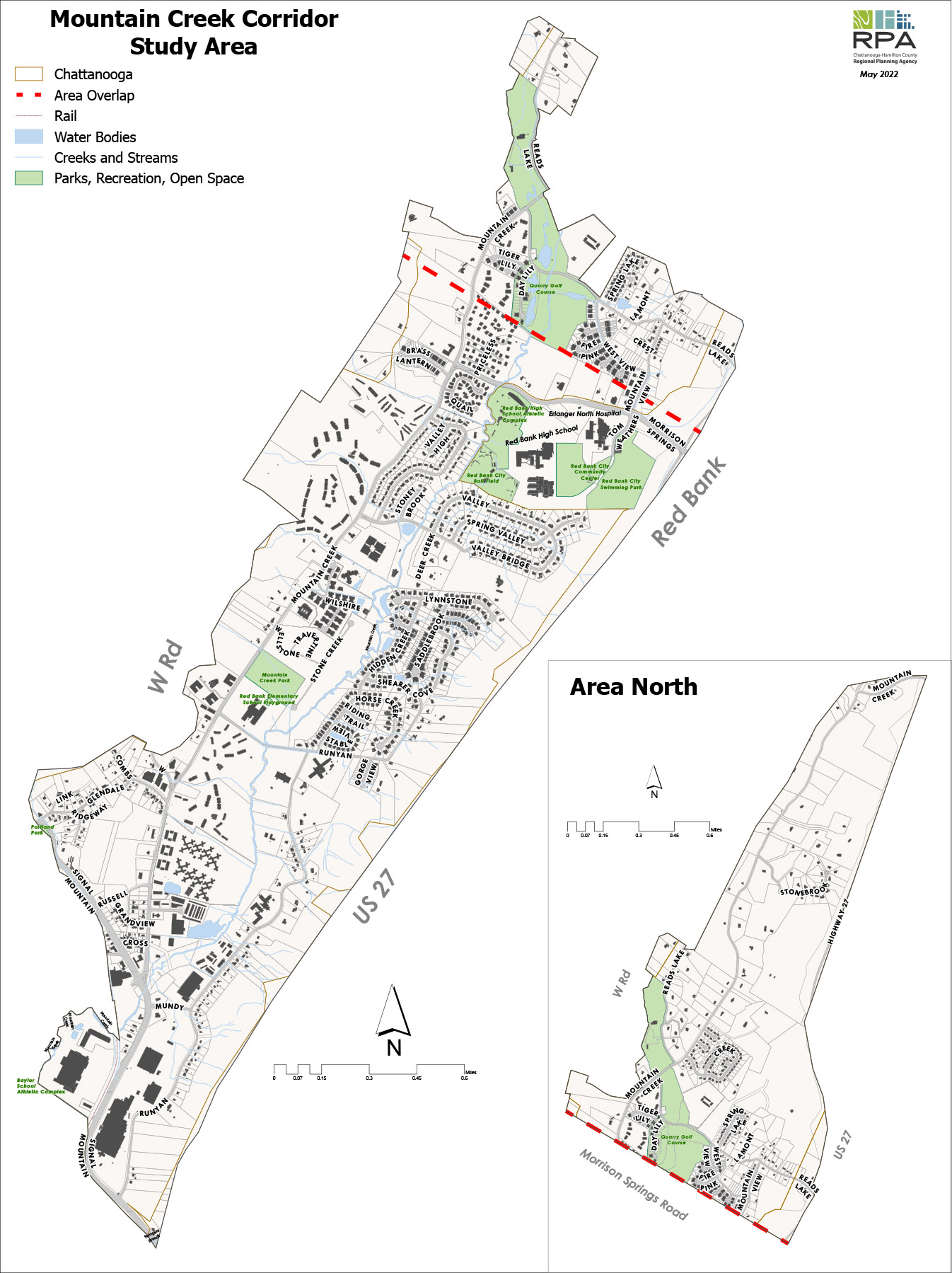
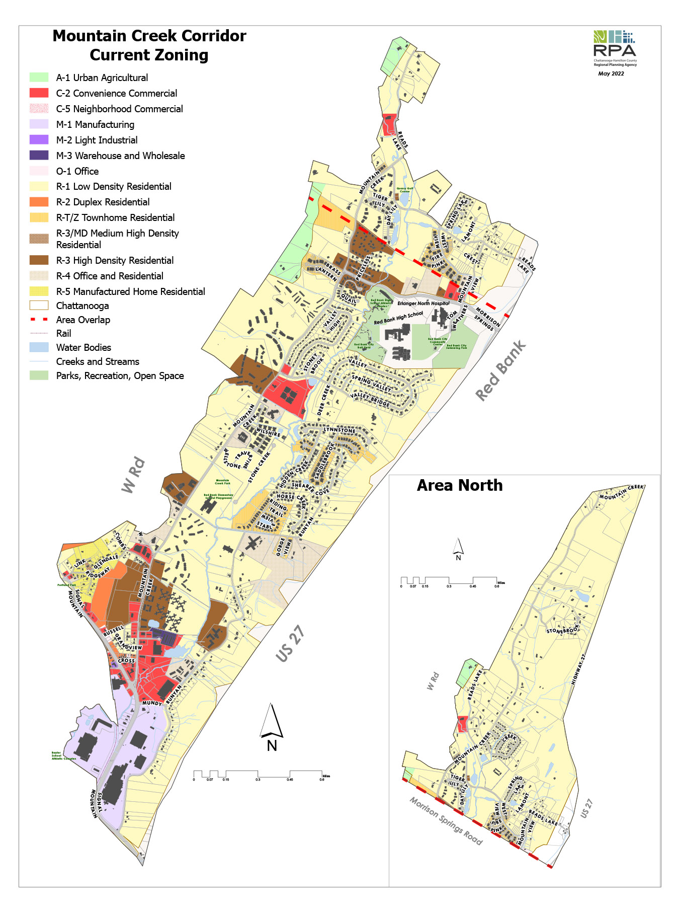
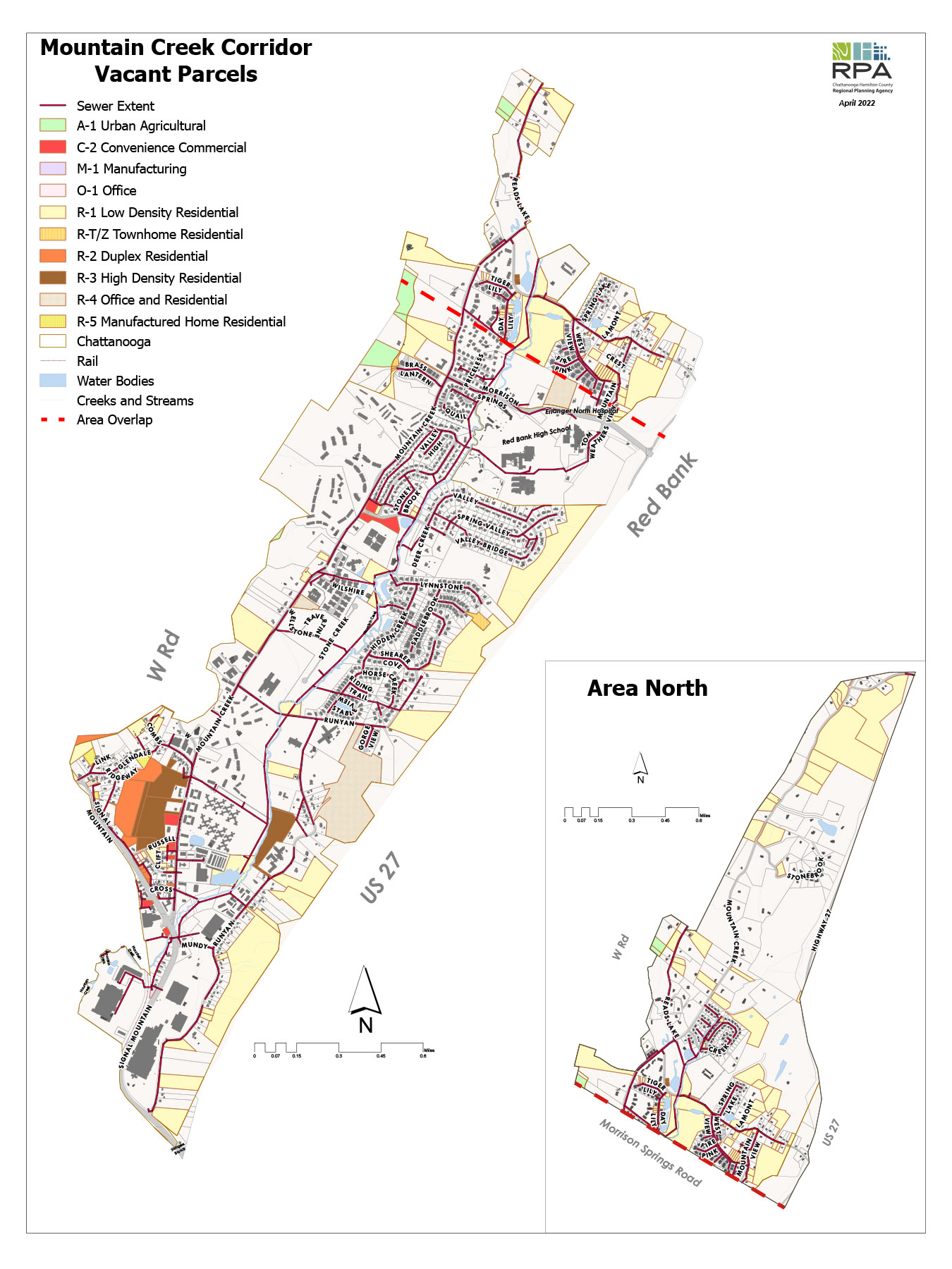
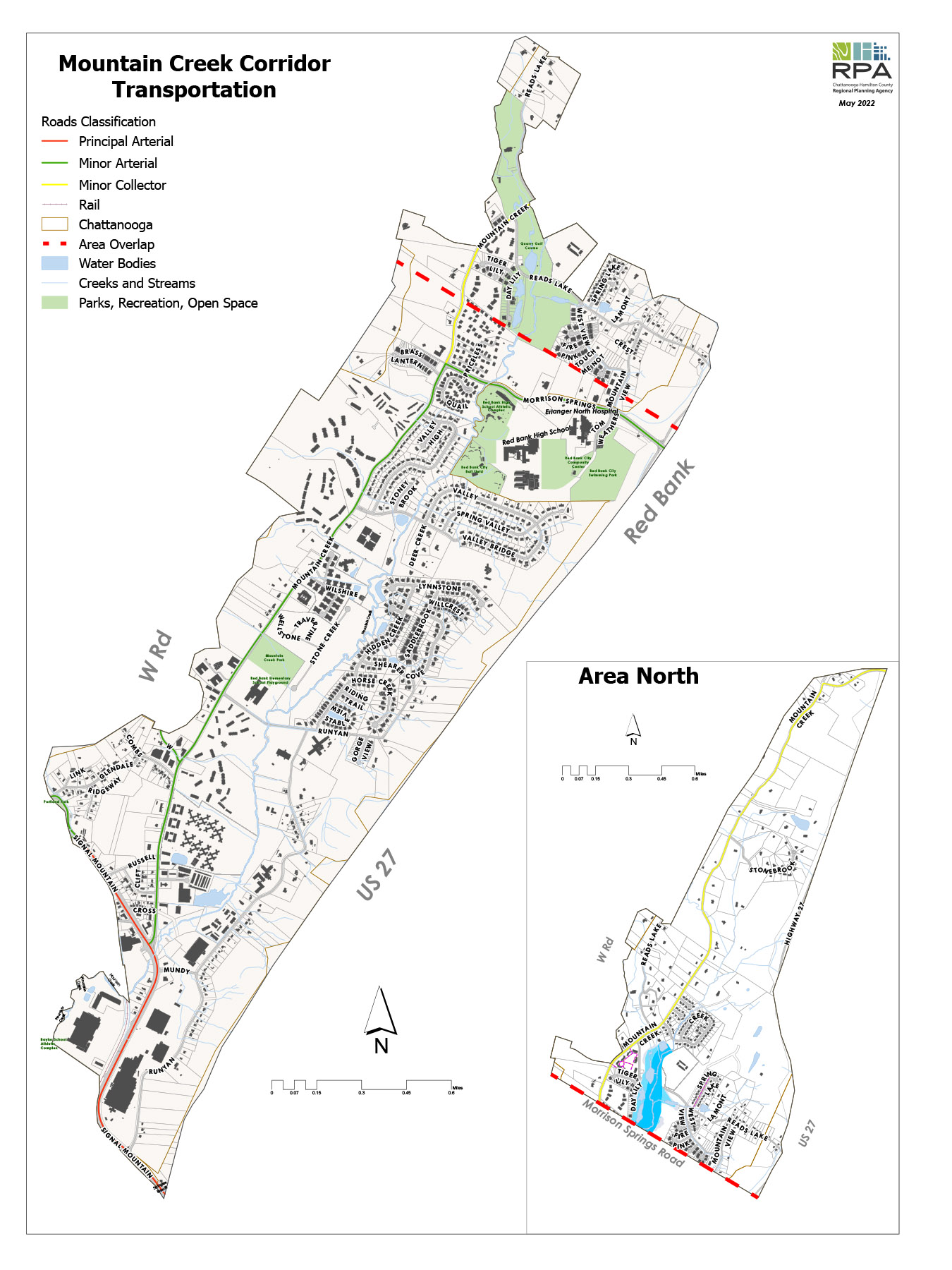
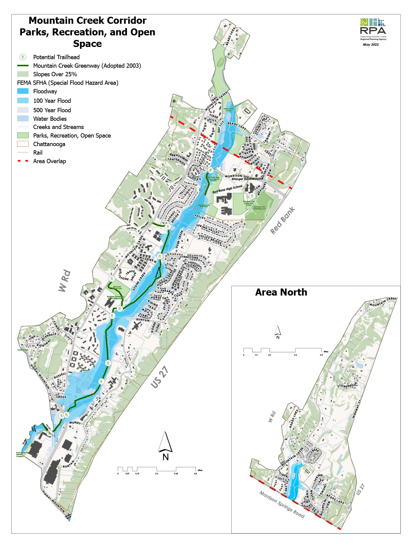
The study boundary extends from the intersection of Signal Mountain Road and Mountain Creek Road to the Mountain Creek Road and U.S. 27 interchange and includes the slopes below the W Road and Highway 27. The Mountain Creek Corridor Study is a limited scope study of Mountain Creek Road and the residential and commercial areas nearby. The following map shows the boundaries of the study area, the full length of Mountain Creek Road from Signal Mountain Road to the US 27 exit at the north end and including everything between the slopes of Signal Mountain and US 2. This study will explore the future of the area, including the potential for the construction of the previously adopted Mountain Creek Greenway (adopted February 2003), the amount of vacant residential land and current zoning, the extent of environmental constraints such as floodplains and slopes, the extent of infrastructure such as sidewalks and sewer, and the level of vehicular traffic.
Public Meeting #1
A community meeting was held June 16, 2022 at Red Bank High School regarding the development potential of the corridor. The RPA staff gave two brief presentations of their initial analysis, with each followed by some time for community feedback and questions. The community shared ideas and feedback on the following issues: Current zoning, development potential, environmental constraints, transportation, and the Mountain Creek Greenway Master Plan (adopted in 2003).
Public Meeting #1, Powerpoint Presentation
Mountain Creek Corridor Study public meeting flyer
STAY INVOLVED
Click one of the icons below to sign up for the Mountain Creek Corridor email list, or to submit any comments about Mountain Creek Corridor. Once you sign up for the email list, you will start receiving periodic updates and other current information about the study.
1 | Subscribe
Subscribe to the E-mail List!
Mountain Creek Corridor Study Area Maps
Click on the links below to download maps.
